Warm Weather Expected Across SA, But Cold Front To Hit South-West On Wednesday

Most of South Africa is all set to experience warmer weather in the coming days but the southwestern region should prepare for a cold front on Wednesday.
A forecaster at the South African Weather Service (SAWS), Samkelisiwe Thwala said that on Monday rain showers are expected from afternoon onwards in the central and western parts of the Western Cape, with the rain spreading to other areas by this evening.
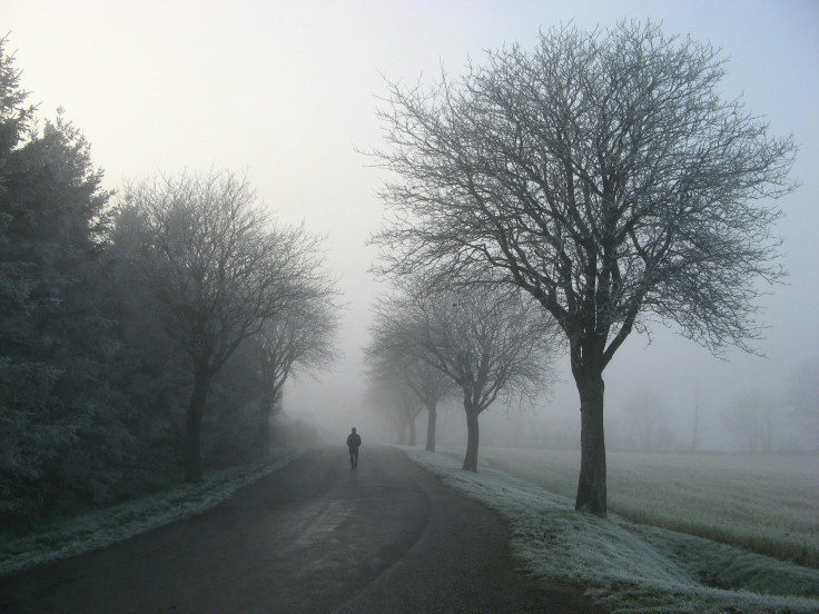
This follows a weekend of freezing temperatures and snowfall in some areas, which led to dangerous road conditions and resulted in one death.
"Tomorrow will be mostly partly cloudy for most of the country in the morning. This will clear from the west throughout the day," Thwala said, SA News reported. "We are expecting temperatures to be warm in most parts of the country, but still relatively cool over Gauteng and Mpumalanga."
She added, "The extensive backlog of traffic between KwaZulu-Natal and the Free State has been cleared. Motorists are advised to resume their travels on Monday, 23 September 2024. Although the roads are cleared, road users are urged to drive cautiously as some roads remain slippery, and weather conditions limit visibility."
However, SAWS said that on Wednesday a cold front will be approaching from the west and showers are expected in the southwestern parts of South Africa, spreading along the south coast.
The Government Communication and Information System (GCIS) expressed gratitude on Sunday night to all citizens, emergency services, government agencies, humanitarian organizations and stakeholders for their support during this difficult time.
Unfortunately, a 39-year-old woman lost her life on Saturday after getting trapped in a blizzard on the N3 between Van Reenen's Pass, which connects KwaZulu-Natal and the Free State.
Last week, SA Weather Service said weather conditions are expected to change in many regions in South Africa thanks to a cold front and cut-off low-pressure system that will introduce wintery conditions to the Western Cape, southern parts of the Northern Cape and the Eastern Cape from Sept. 19.
It was predicted that colder weather would move into KwaZulu-Natal, the Free State and Mpumalanga on Sept. 20. By Sept. 21, it will also reach Gauteng, Northwest and Limpopo.
Cold daytime temperatures of 4 to 8°C were expected in the high areas of the Eastern Cape, eastern Free State and interior of KwaZulu-Natal, where widespread snowfall is likely. The weather service urged South Africans to regularly follow weather forecasts on television and radio.
© Copyright 2025 IBTimes ZA. All rights reserved.
- MOST POPULAR IN National