Heavy Rain, Thunderstorms Expected In Eastern Cape, Kwazulu-Natal, Free State

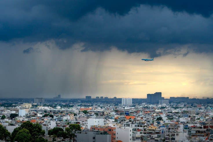
The South African Weather Service (SAWS) warned that the Eastern Cape and KwaZulu-Natal will see heavy rain while severe thunderstorms are expected in the Free State, North West and Northern Cape.
The heaviest rain is expected from Monday evening to Tuesday afternoon. The heavy rain may cause flooding of roads and settlements, pose a danger to life, disrupt essential services, temporarily cut off communities and damage roads and bridges, SA News reported.
On Monday, KwaZulu-Natal is expected to see widespread showers, particularly in the southeastern parts of the province. Some areas have already recorded significant rainfall, with Mount Edgecombe receiving 146 mm.
As rain continues in some areas, there is a risk of flooding on roads and in settlements, damage to infrastructure, and issues for mud-based houses.
The province has been warned about the likelihood of flooding in both formal and informal settlements, danger from fast-flowing streams and deep water, major disruptions to traffic flow from flooded roads, and interruptions to essential services like water, electricity and communication.
Conditions are also favorable for severe thunderstorms, which could bring heavy rain of more than 40 mm in the Free State, central and western Northwest, and northeastern Northern Cape on Monday. These storms may come with strong winds, excessive lightning, and hail.
Such conditions are expected to lead to flooding in low-lying areas, possibly resulting in road and bridge closures, injuries, and threats to life.
"A cut-off low-pressure system, surface trough and ridging high will result in scattered to widespread showers and thundershowers resulting in flooding in places," SAWS said.
It added, "Disruptive rainfall is expected associated with a cut-off low move over the Eastern Cape, while a surface high pressure south of the land feeds in a deep layer of moisture over the province. The Koukamma, Dr Beyers Naude, Blue Crane Route, Makana, Raymond Mhlaba LMs will be affected from Monday into Tuesday evening."
Latest weather models indicate that rainfall along the south coast is increasing. A high-pressure system to the south will bring a lot of moisture to the Eastern Cape, resulting in heavy rain along the southeast coast, particularly between Cape St Francis and Port St Johns.
The heavy rain may cause flooding in both formal and informal settlements as well as on roads and bridges. It could also damage infrastructure and create dangerous driving conditions due to slippery roads and low visibility. Some areas may become isolated because of flooded roads.
© Copyright 2025 IBTimes ZA. All rights reserved.
- MOST POPULAR IN National